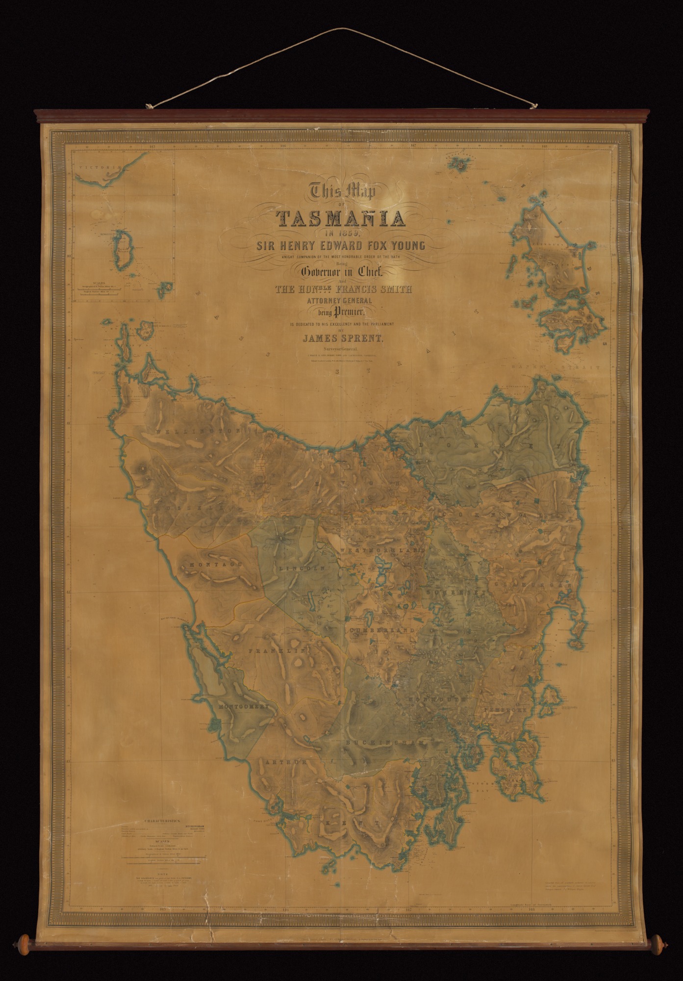
Mapping a rugged landscape
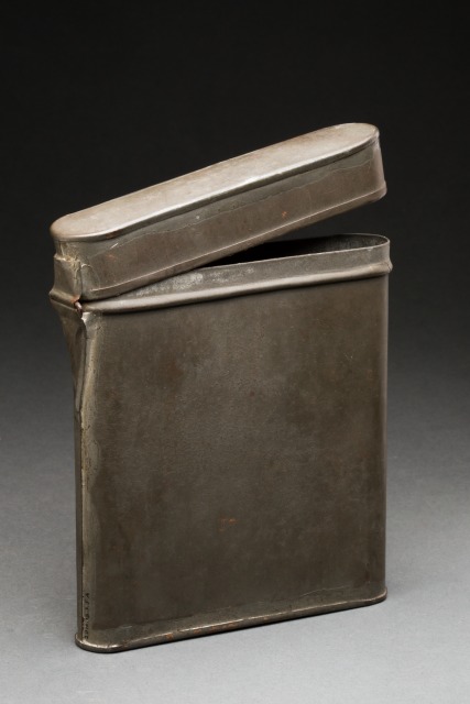
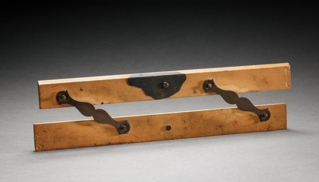
In 2012 the Museum acquired a small collection associated with the distinguished career of the Surveyor-General of Hobart, James Sprent. The collection includes a large and very early map of Tasmania, Sprent’s degree certificate, a Reeves parallel ruler, three small certificates for short courses at the University of Glasgow and a wooden box which is likely to have held Sprent’s drawing instruments. The map was the first accurate map of the colony and the first to reflect the colony’s name change to ‘Tasmania’.
James Sprent was born in Manchester, England in 1808, the son of a publisher from Glasgow. Sprent was a scholar at St John’s College, Cambridge and University of Glasgow. He was awarded his Master of Arts from University of Glasgow in 1825. At the age of 22, he sailed to Australia aboard the Norval and arrived in Hobart Town in May 1830. Shortly after his arrival in Hobart, Sprent started a school for young gentlemen teaching a variety of subjects including Latin, Arithmetic, Mathematics and French. His ultimate intention was to establish himself on the land; however, the Colonial Office rejected his application for a free land grant despite his available capital.
In 1833, Sprent was appointed Assistant Surveyor for the survey department and began the task of producing an accurate map of the colony. Sprent, with fellow Assistant Surveyor James Calder, embarked on an arduous task to record a trigonometrical survey of the whole of Van Diemen’s Land. Sprent was the first surveyor in Van Diemen’s Land who had qualifications in mathematics. The combination of his qualifications and Calder’s practical knowledge of the terrain made for a strong team. The rugged landscape and testing weather conditions contributed to the difficulty of the task.
Sprent and Calder worked on the survey for five years establishing 50 station points and drafting an interim chart. In 1837, the survey was suspended due to severe economic problems in the colony. The discovery of many incorrect property boundaries concerned the government, so by suspending the survey they avoided the possibilities of contentious issues with existing landowners.
The survey was suspended for 10 years and during this time Sprent continued working as a surveyor on various projects around Hobart. One of his most significant projects was an extensive large scale survey of Hobart Town. He produced over 70 highly detailed street plans, which were bound together into a large volume, referred to as Sprent’s Book.
In 1847, under the new governance of William Denison, Sprent and Calder recommenced the trigonometrical survey and for the next six years recorded 206 observation stations. The survey was finally completed in 1853 and Sprent retired from fieldwork shortly afterwards; the years of the survey work had taken a toll on his body.
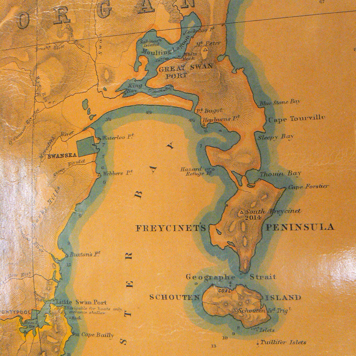
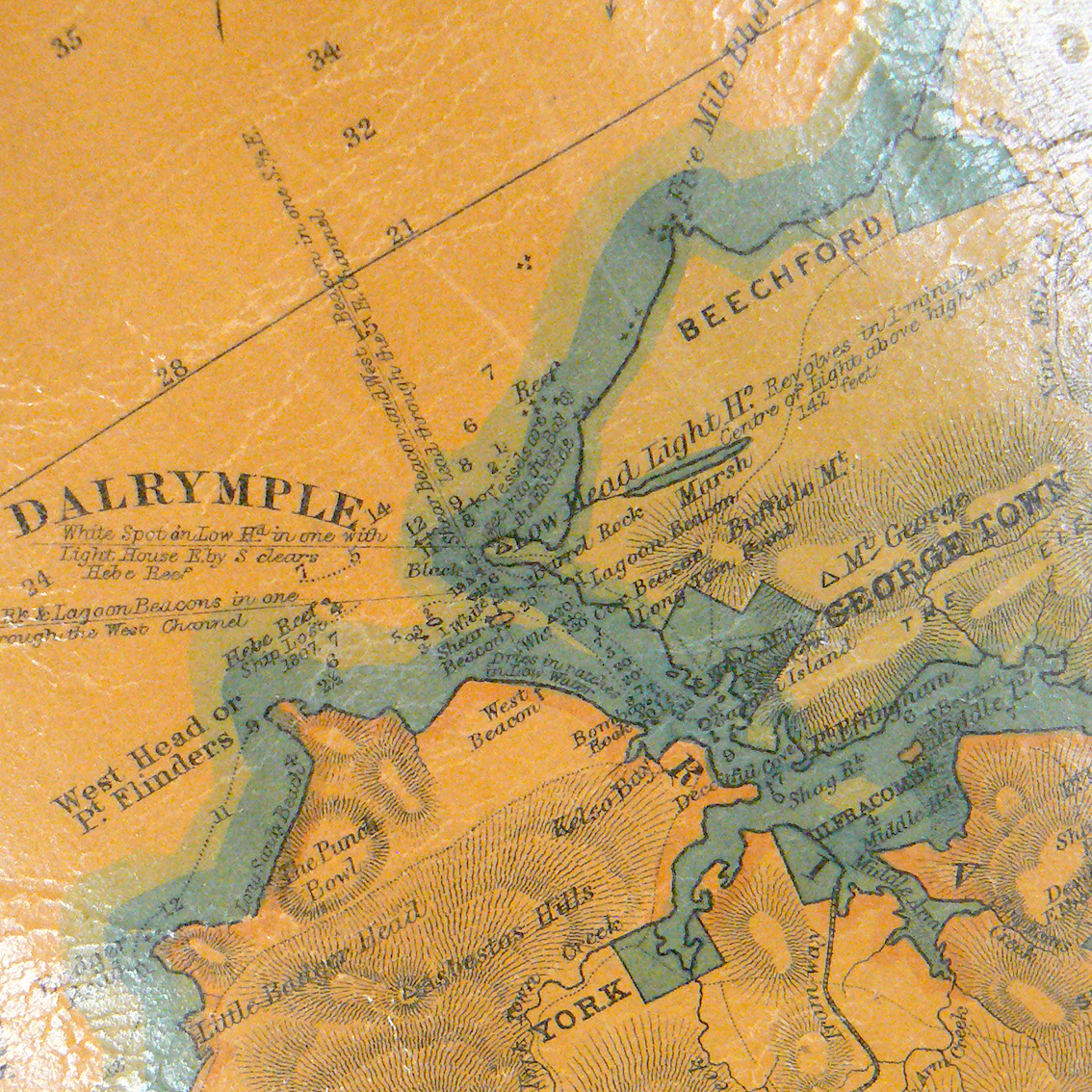
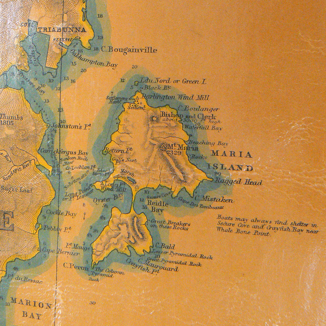
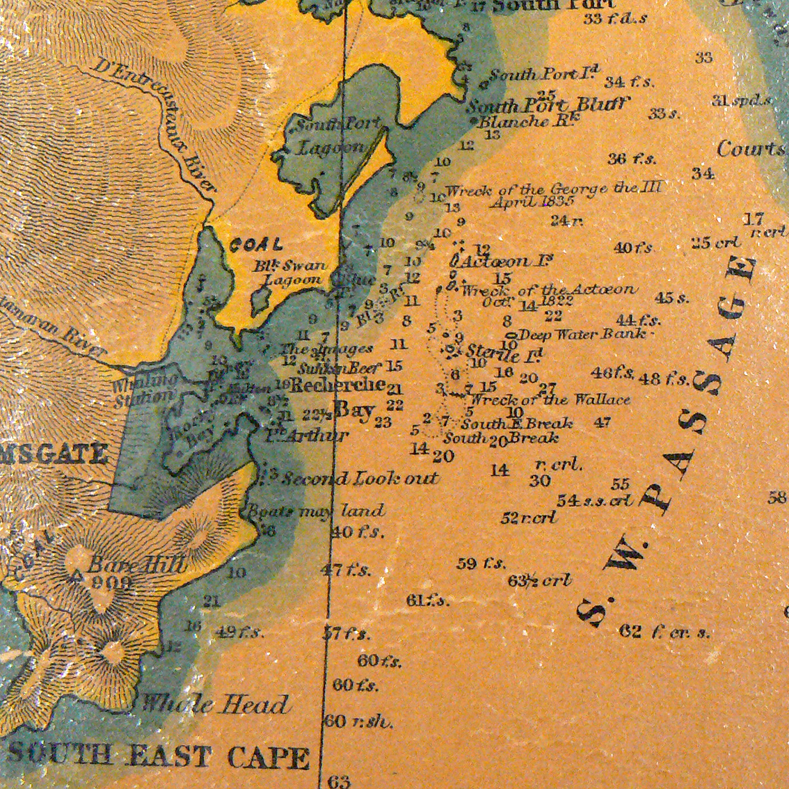
Detailed sections from Sprent’s map
Click on these small sections to get an idea of the level of detail recorded on the map -boundaries of counties, towns and villages, roads and rivers, trigonometrical points, altitudes of mountains, soundings in fathoms, sandbanks, reefs and rocks, shipwrecks, lighthouses and tidal information.
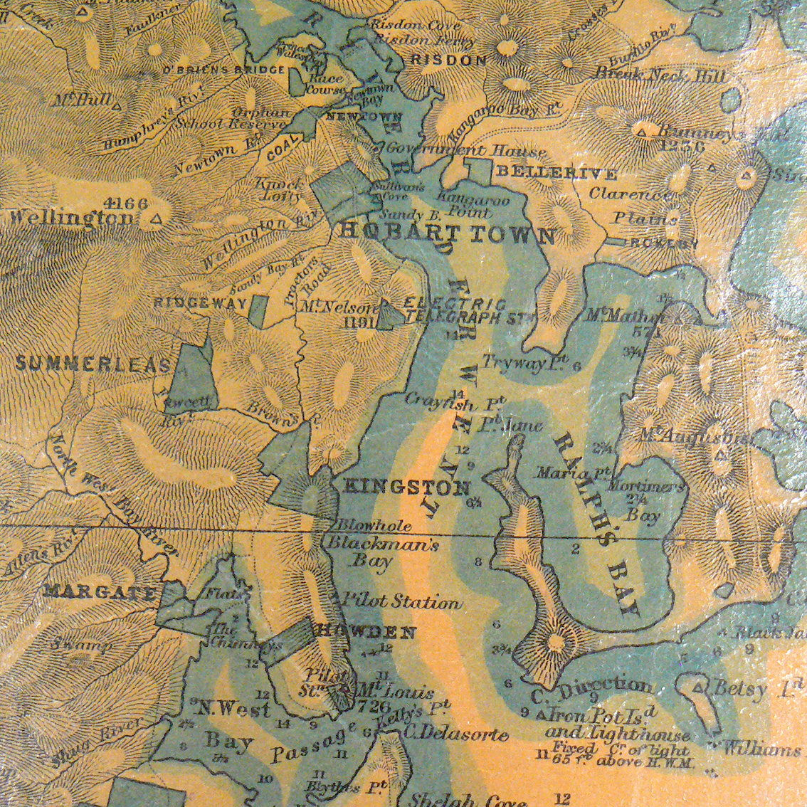


Photos: Catriona Donnelly
Production of the map began in 1858, it proved to be a costly exercise but the final product was the most comprehensive and largest map anyone had ever produced of the Australian colonies. Four large hand engraved copper plates were required in order to reproduce the coloured map. Map publishers W. and A.K. Johnston of Edinburgh, Scotland, printed the map. Copies of the map reached Hobart in June 1859 and were offered for sale in four formats, the most expensive, printed in colour, varnished and mounted on mahogany rollers sold for £3 13s 6d. The Museum’s copy is the largest version mounted on mahogany rollers.
Other objects in the James Sprent collection
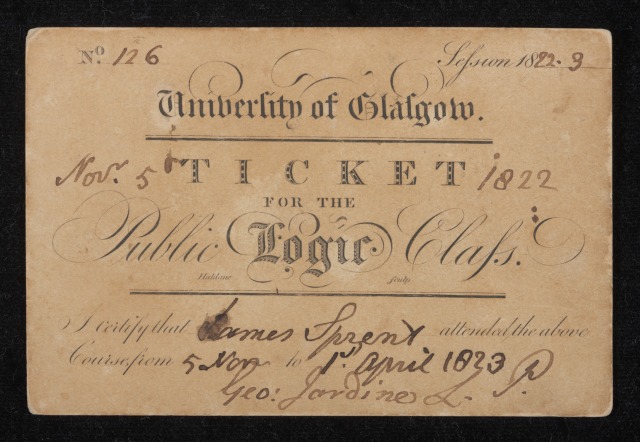
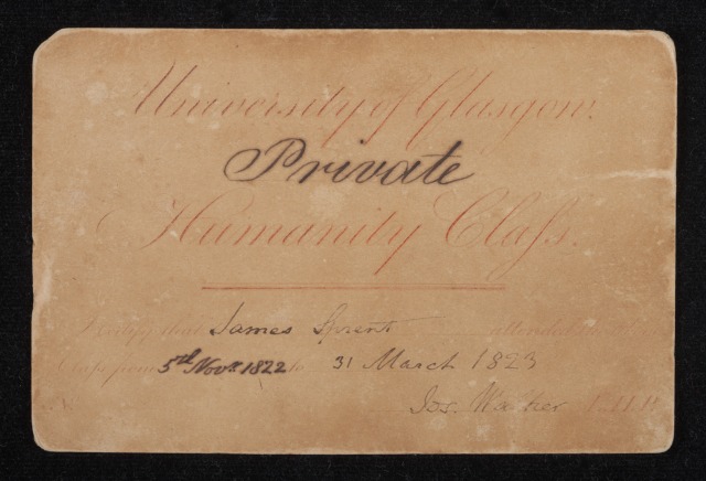
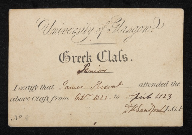

Three small certificates for short courses in Public Logic, Humanity and Greek, 1822-23
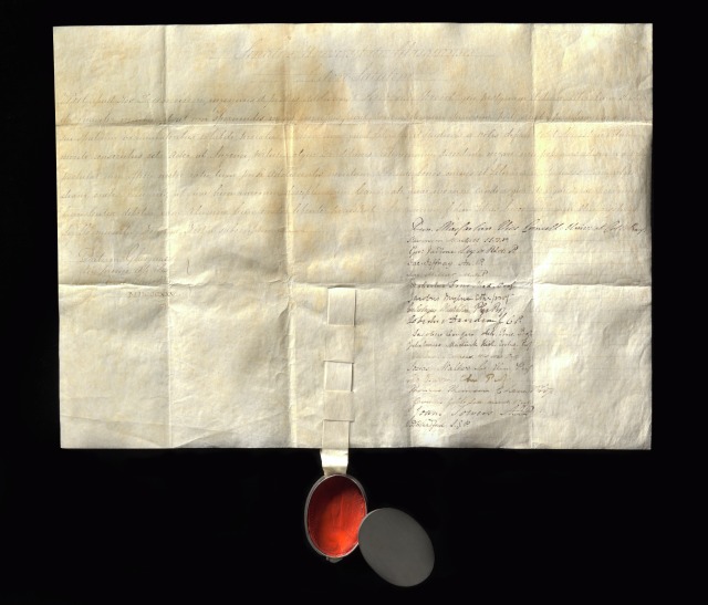
James Sprent’s degree signed by 18 academics from the University of Glasgow, 1825
Zinc document case and wooden box. Photos: Katie Shanahan
Reeves parallel ruler. Photo: Jason McCarthy
During the early 1850s there were extensive changes happening in the political, social and economic structure of the colony. These changes also flowed on to the survey department. There was a move towards employing civilians in positions previously held by military personnel. In 1855, James Sprent was the first civilian to be appointed to the position of Deputy Surveyor-General, which was then followed by his promotion to Surveyor-General in 1858.
Sprent married Susannah Hassall in 1842 and they had five children. Tragedy struck in 1853 and his two eldest sons died from a scarlet fever epidemic. Sprent’s youngest son, Charles Percy Sprent, eventually followed in his father’s footsteps and in 1883 became the District Surveyor. He was instrumental in the founding of the professional body for surveyors in the colony.
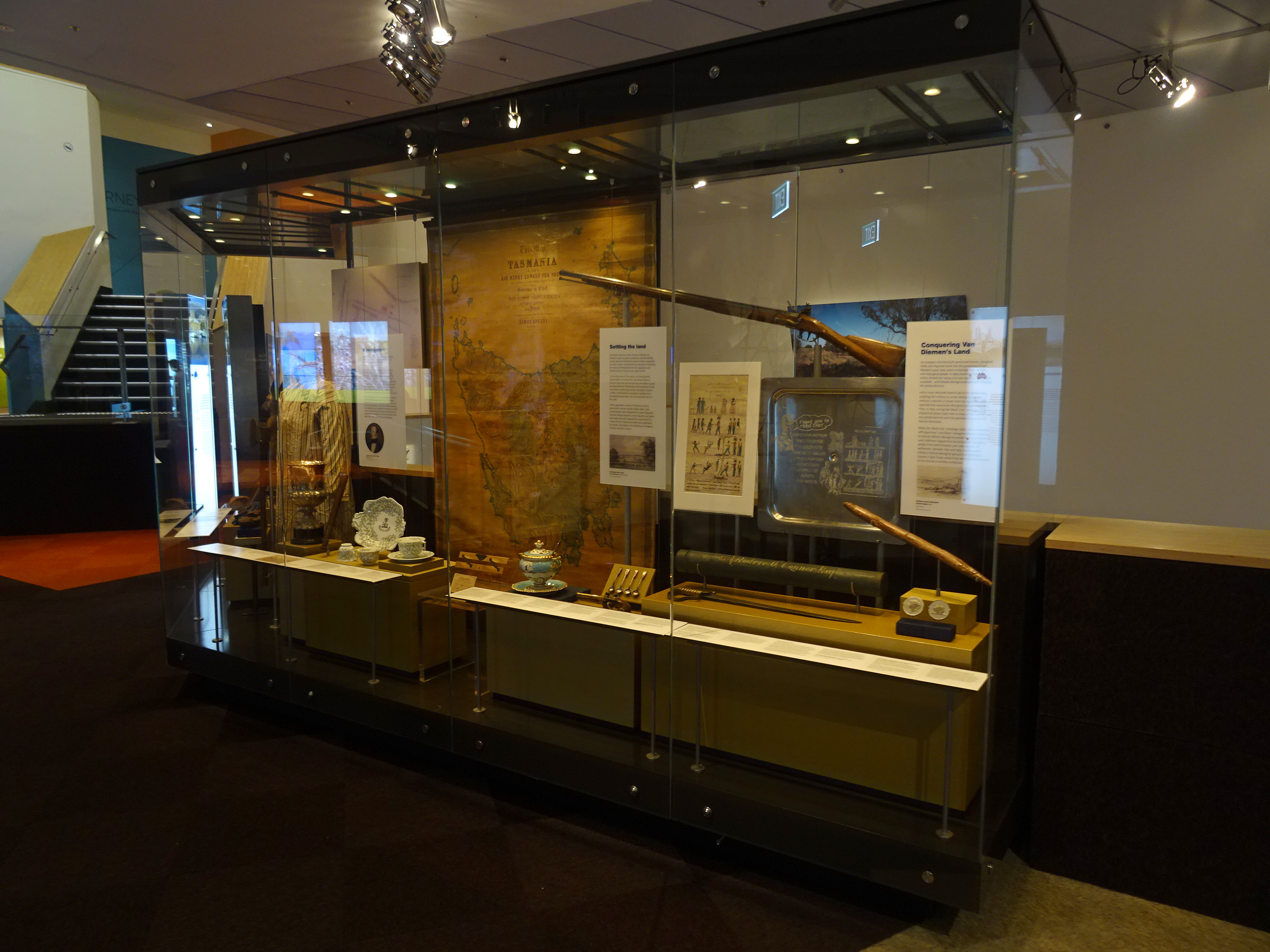
James Sprent’s map, parallel ruler and short course certificate are currently on display in the Hobart exhibit in our Landmarks gallery.
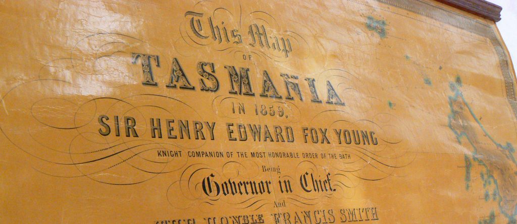
Feature image: Detail of map title. Photo: Catriona Donnelly