Moving to still
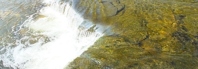
One characteristic of water is that it is always moving, albeit at very different rates. Even ice moves. Alice Outwater in her book Water: A Natural History, says that ‘A single water molecule making its way through a stream and forest ecosystem is on a biological Ferris wheel. A raindrop may hit a leaf, trickle down to the bark of a branch, evaporate to come back down again as rain that flows into soil and is sucked up by a root hair and is transpired from a leaf – to become yet again a raindrop that comes down in a storm and runs overland into a stream’ (Outwater, p. 64).
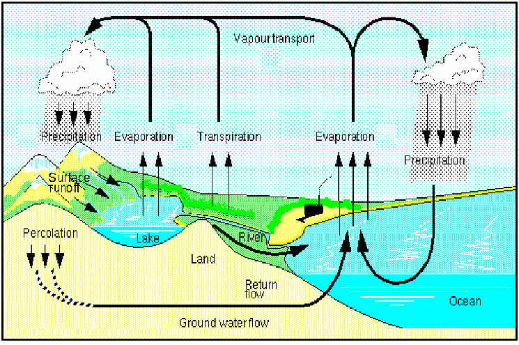
The movement of water is a defining characteristic of the hydrological cycle. The rate of movement in the hydrological cycle is essential to how it performs its many ecological functions. Humans have responded very differently to water scapes depending on the rate of water movement. Water moves through different pathways and at different rates, performing different functions. No one function, path or rate is any better than another. Yet, historically, peoples of European descent have expressed preferences for surface waters, in clear open lakes or defined streams. More importantly, it has undertaken significant interventions into the hydrological cycle to rectify these perceived deficiencies.
This spectrum uses one collection to explore these poles of movement in water, and some of the political controversies they helped to define. It’s the Bob Brown collection, former senator and leader of the Greens party, which documents his many political activities in his adopted state of Tasmania.
Pedder pennies
The Pedder pennies are geological specimens, recovered from the bottom of Lake Pedder before it was drowned for a hydro-electric dam. At their centre is a quartzite pebble while the rim or coating is made of mixture of iron and manganese. The pennies are, to be frank, visually underwhelming, and a reminder that significance and beauty are not necessarily linked. The Pedder pennies tell a geological story that illuminates Australia’s deep past. Speaking at a forum in 2001 geologist Kevin Kiernan said ‘If Pedder Pennies were biological organisms then the differences between the Canadian examples and Lake Pedder examples, or between the distinctive concretions from Lake Pedder and those from Basin Lake, would probably be sufficient to warrant the recognition of a new species – species that would then attract general acceptance as appropriate targets for conservation’ (Kiernan, p. 42).
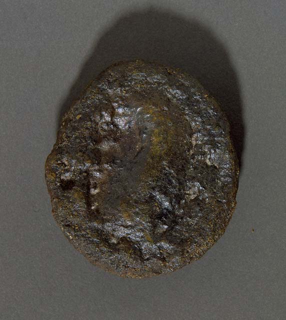
Most pennies were found on the northern, more gravelly side of the lake, but some were also found in the also submerged Lakes Maria and Edgar. Kiernan notes that their shape is ‘hydro-dynamically poor’ and the presence of the manganese would have been less likely in a high energy stream. Put simply, Pedder pennies can only have developed in slow moving or still waters. Otherwise the iron/manganese rim would have been knocked off.
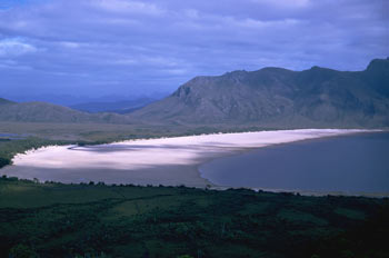
Lake Pedder was a small glacially formed lake that was part of the Serpentine drainage basin. In summer higher evaporation shrank the lake from its winter size of approximately 9.7 kilometres square, and exposed beaches that in some lights appeared white and others pinkish, the result of its quartz sands. Its pink beach was a major contributor to how it was perceived by white settlers. In 1835, surveyor George Frankland said that it lay ‘in the heart of the most romantic scenery’. Subsequent explorers were equally admiring. It was first photographed by George Innes in 1896, but it was not until Lloyd Jones took aerial photos and landed a plane on the beach that word of the beauties of Lake Pedder began to spread outside the surveyors, explorers and amateur scientists (Griffin, p. 16). It was included in a National Park in 1955 in recognition of its scenic beauty. However, this listing did not protect it. Just as a government can create a national park through formal gazettal processes, it is equally capable of de-gazetting.
A subsequent national enquiry following the lake’s drowning found that the work undertaken to investigate the lake’s biological, geological and ecological values was inadequate. Reviewing various classification systems for lakes, Kiernan concluded that ‘No formal land classification system advanced to date adequately covers [the diversity of Lake Pedder]’ (Kiernan, p. 40). As a glacial outwash impoundment, Lake Pedder is unique in Australia and New Zealand, highly unusual in the southern hemisphere, and on that basis, clearly meets world heritage criteria.
Ironically the drowning of Lake Pedder was so that a bigger lake could be substituted, one that was more amenable to the desire for water control and power generation. Large volumes of impounded water are the mainstay of traditional hydroelectricity schemes, and the scheme that drowned Lake Pedder became the largest man made lake in Australia. (The new Lake Pedder is approximately 242 square kilometres.) To impound means to detain, to seize or to take into formal custody. The language is itself revealing, a perception that the water has been naughty and needs time out, rather than moving in its own interconnected ways and doing its own powerful ecological work.
Hydro-electricity was pursued as a policy of economic development in Tasmania, primarily to attract foreign capital with the promise of cheap, renewable energy. This was to combat Tasmania’s long history of being economically under par compared to mainland states. In pursuing this policy, the Tasmanian government was following centuries of tradition. The use of water as power has an extremely long history. For example, the Domesday book recorded 5624 water mills in England south of the Trent River. There was an excellent reason for this. In the Saxon era, small 2 hp Saxon style waterwheels could do the work of 30 people using hand mills, and had the added advantage of not needing extra land to grow fodder for horses (Owen et al., p. 104).
Europeans therefore have a long historical understanding of how water can be put to work in the their own service. It’s difficult to generalise about whether or not people understood how water ‘works’ for other species, but up until the advent of the modern era the scale of human alteration to water systems was limited and the question was not quite so pressing. The understanding of ‘working’ water within a landscape was not a particularly common point of view in the early 1970s, except among scientists and conservationists. Much of the community opposition at the beginning of the campaign to save Lake Pedder was from people who appreciated the uniqueness of the place, who were moved by its beauty and who felt that the extra power generated was in no way a meaningful compensation for its loss.
Sheet music
By the time the proposal came for the Gordon Below Franklin scheme, there was a much better understanding of the interconnections between hydrology and ecology, but still, it was not a fully persuasive argument for the majority of people. While the science argument most certainly played a role, a great part of the campaign to save the Gordon Below Franklin employed the imagery of wild, moving water. The most famous image from the campaign was Morning Mist, Rock Island Bend, Franklin River by Peter Dombrovskis.
In the spectrum of still to moving water, cultural projections have a strong role to play in understanding how we react. Open expanses of water are preferred, with clear edges and well defined boundaries. Lake Pedder filled this cultural preference beautifully. What would have happened if the Lake had been equally scientifically significant but of a nature that could not produce such photographs? What if, in short, it had been a swamp where you couldn’t see past the nearest clump of vegetation? The other cultural preference is for smoothly flowing water in a defined channel, rivers and creeks. You only need to consider the language of water to understand this. When we want to disparage something, we call it a swamp, a backwater, or a bog. However, we often use words associated with flowing water to indicate progress and positivity.
Our second object is the sheet music printed to accompany the song ‘Let the Franklin Flow.’
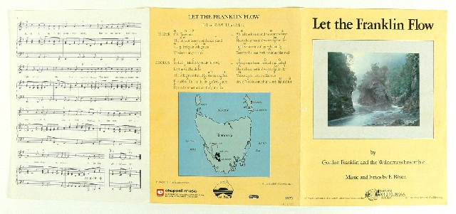
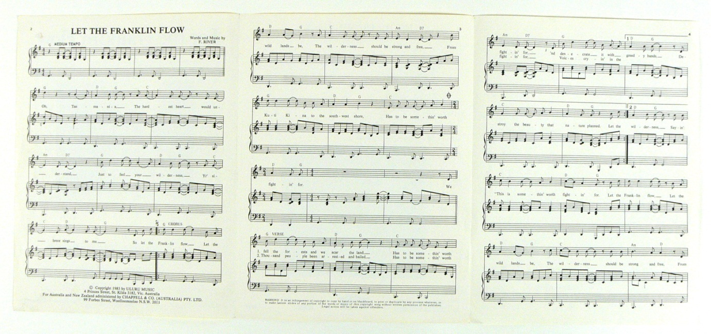
Composed by Shane Howard of Goanna, sales from the single went to the campaign against damming the Franklin. The words emphasise the beauty and majesty of the river, its wild and untrammelled nature. It is an appeal first and foremost to the heart. It also subverts the traditional use of flow imagery. By contrasting the free flowing nature of the Tasmania’s rivers against the impounded waters of a man made lake, the conservationists successfully challenged ideas of progress that had traditionally relied on hydrological alteration. Leaving hydrology alone and intact was presented as a new version of progress.
Top image: Photo by Clem Rutter, Wikimedia Commons.
References
Kiernan, Kevin, ‘The Geomorphology and geoconservation of Lake Pedder’, in Sharples, C, Lake Pedder: Values and restoration, Occasional Paper no. 27, Centre for Environment Studies, University of Tasmania, 2001.
Griffin, John, On the origin of beauty: Ecophilosphy in the light of traditional wisdom, World Wisdom, Indiana, 2011.
Outwater, Alice, Water: A Natural History, Basic Books, New York, 1996, p. 64.
Owen, Sue; Pooley, Colin; Folkard, Andrew; Clark, Gordon; Watson, Nigel, Rivers and the British Landscape, Carnegie Publishing, Lancaster 2005.
Further information
Lake Pedder historical timeline
‘No Dams’ – 25 years of environmental stickers
